I’m not sure whether to call this a pause for dramatic effect, or just plain laziness.  Ah, who’m I kidding?  It’s not really all that dramatic, is it.

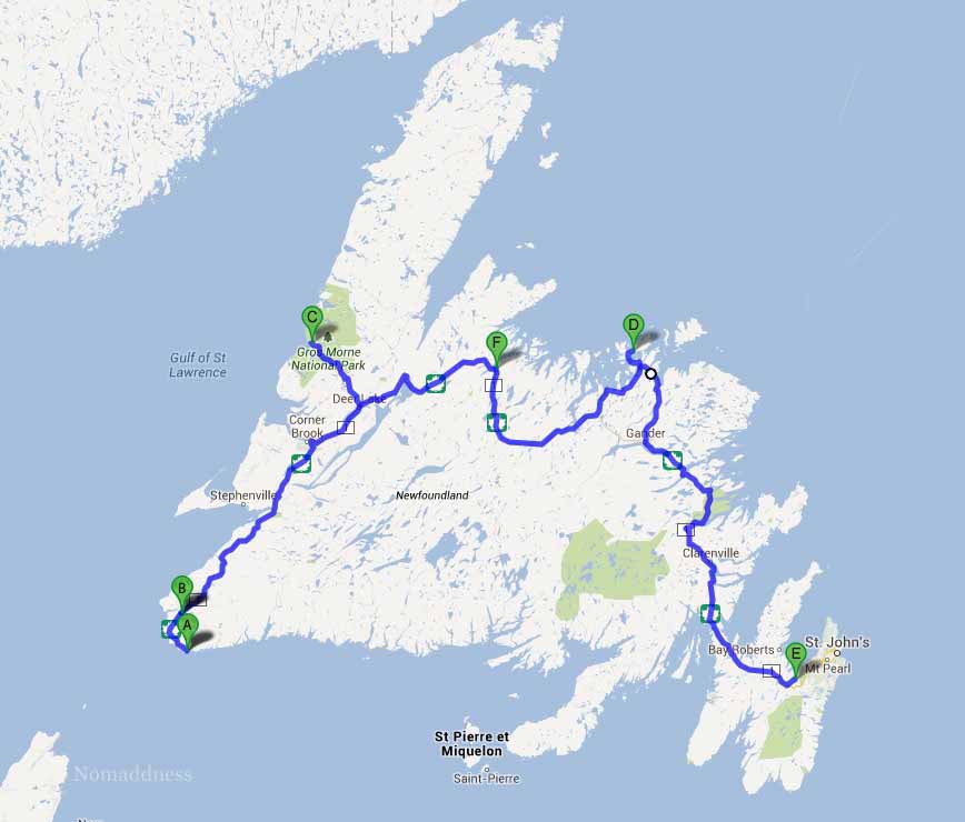
As I mentioned so long ago on Day 8, our destination was a spot called South Brook.  I think I called it “Point F” on that map that I’m so over now.  And, between you and I, calling it Point F makes a good deal more sense than calling it South anything if you consider how far north it is.  Speaking of not making much sense, the campground was (and in all likelihood still is) called Kona Beach which I thought sounded sort of Hawaiian, but does this look like Hawaii to you? Hmmm?

PT1 and PT2 at Kona Beach
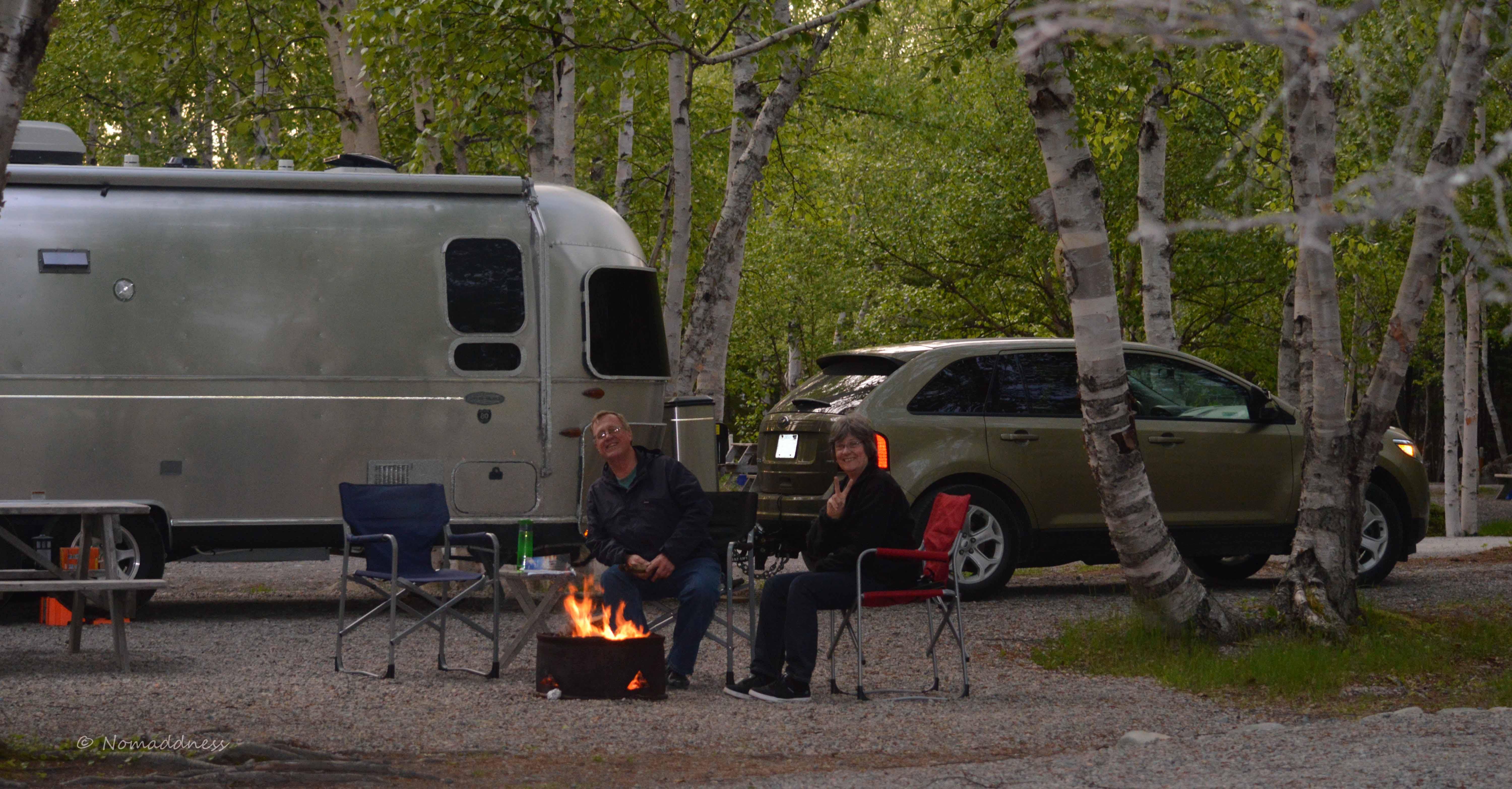
That’s Bob indulging his pyromaniac tendencies, and Shari ordering more beer.

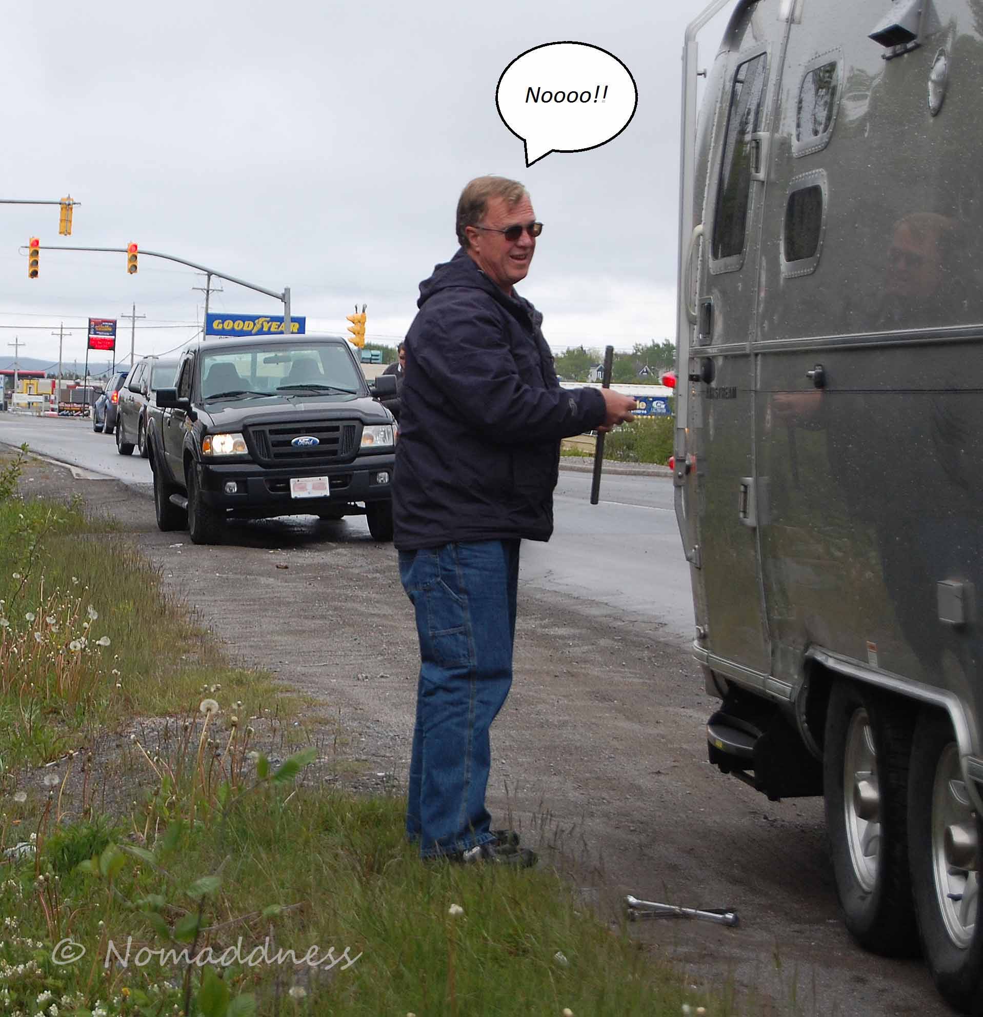
We packed up early on the ninth day of our journey and headed back to the same spot we camped on our first night in Newfieland, Grand Codroy in Doyles.  Once we’d dumped off the trailer, we set about exploring.  It was our last day and we wanted to make the most of it.

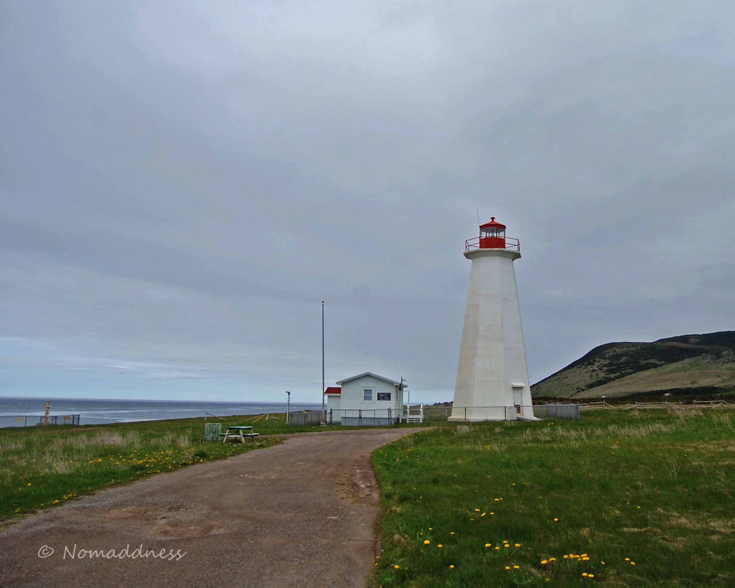
Now, I don’t know if you know this about me or not, but I really like lighthouses. Not quite as much as I like puffins (or bacon) but I find them sort of extremely interesting.  Our TRT (Trip Research Technician…okay, Bob) had located a couple more lighthouses for us to look for.  I say “look for” because sometimes they hide them really well.  I’m not sure how doing that is helpful to boats and such, but there you have it.  Hidden secret lighthouses.  Don’t say I didn’t warn ya about doze wacky Newfies, eh?

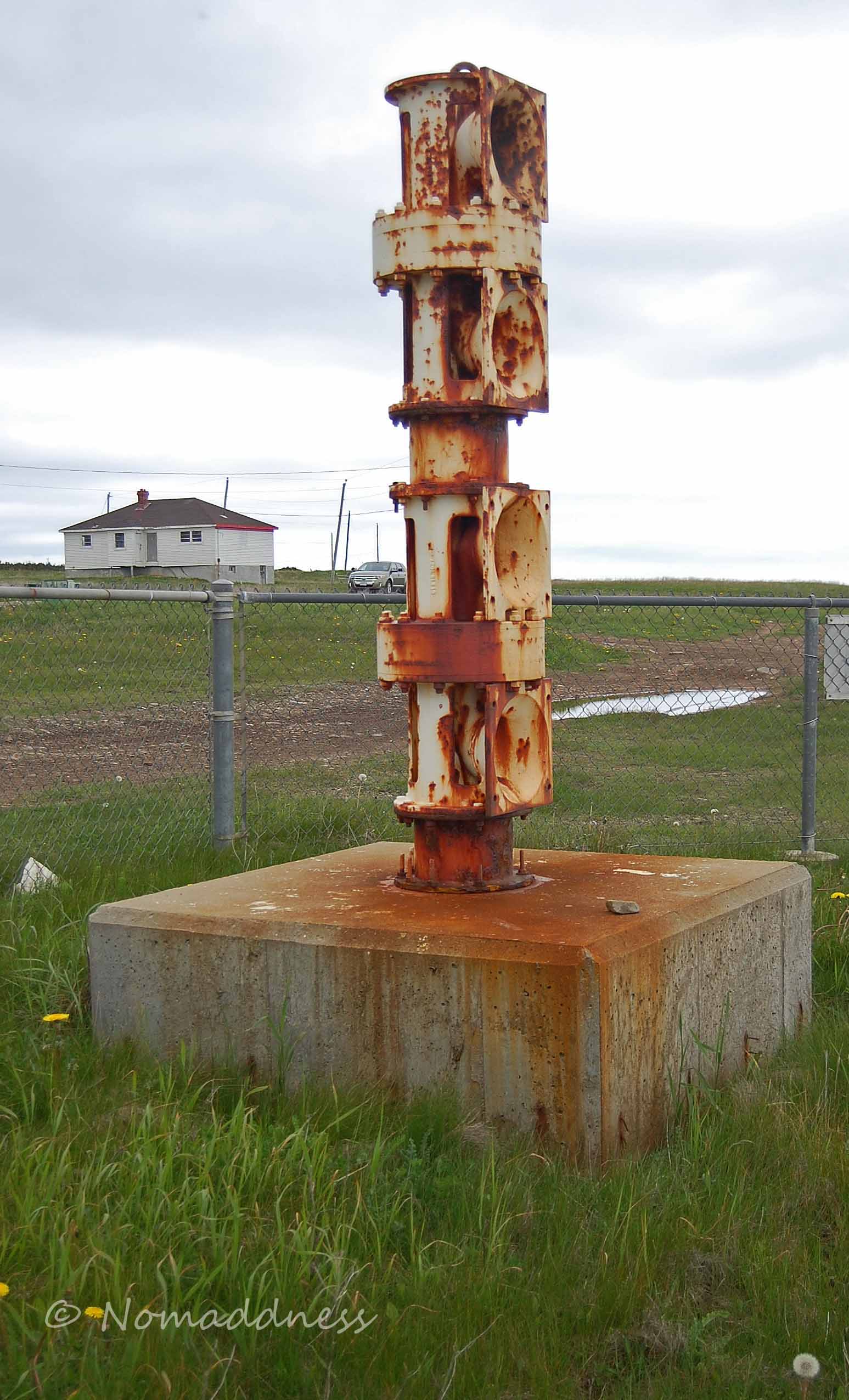
This first one, called the Cape Anguille Lighthouse, is also a fog horn station.  The weird rusty thing is apparently the fog horn.  Looks a bit dodgy to me.  There’s a little sign advising against standing in front of it.  I’d imagine there’d be a risk of an interesting hairdo at the very least.

SDSC_0081R


SDSC_0086R

The second lighthouse required a lot of driving and a fair bit of hiking, but it was entirely worth it.  But hang on a second – I’m getting ahead of myself.  I know, I know, how unlike me.

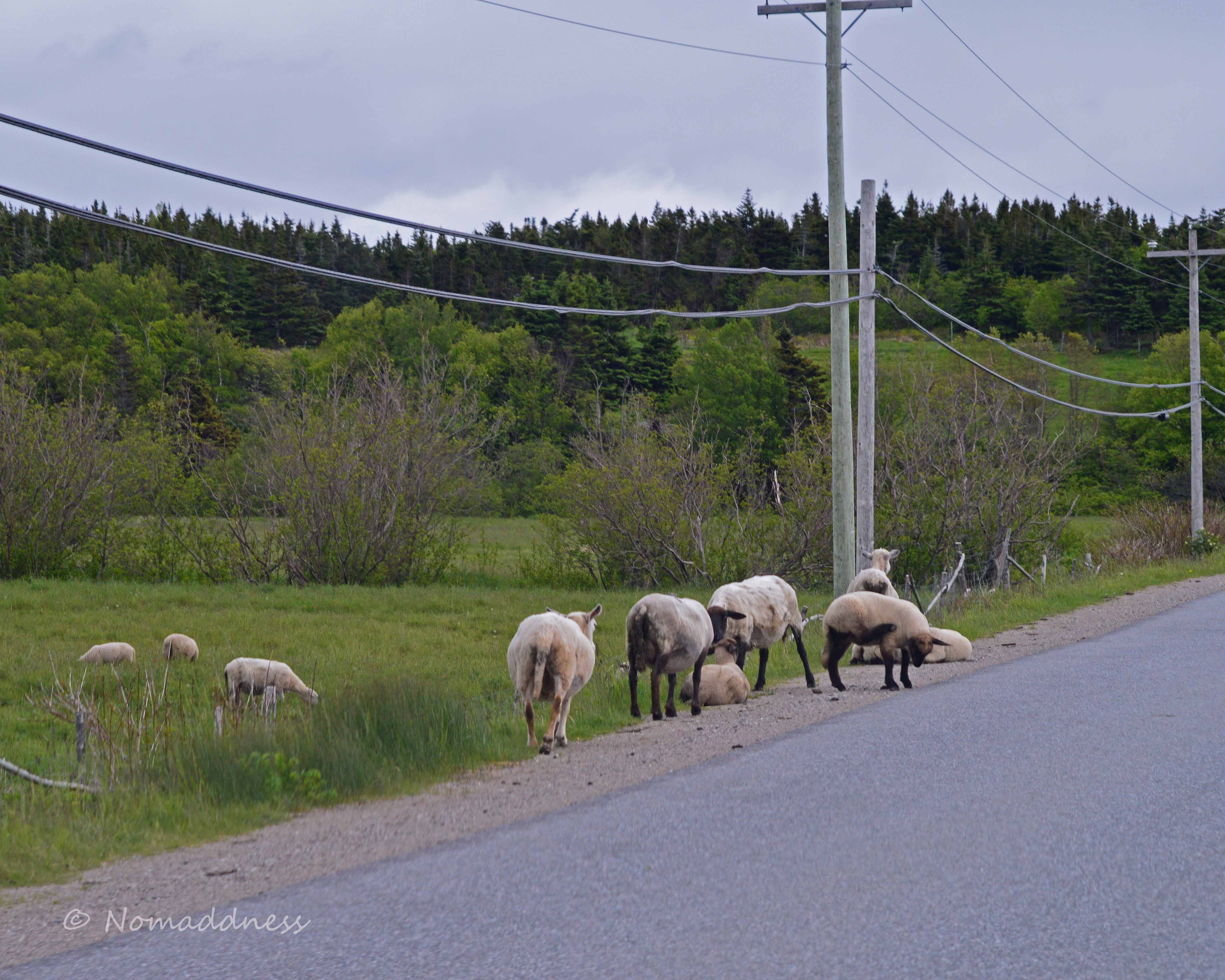
On the way back from the Cape Anguille Lighthouse, we saw some interesting things, not the least of which (okay, maybe it was the least…) was a herd of free-range sheep. Free-range Newfie-style means let’s-put-em-on-da-road-n-see-what-happens (the tourists will think it’s quaint). Um…no. The aforementioned tourists nearly had a mutton hood ornament.

JDSC_0386AR
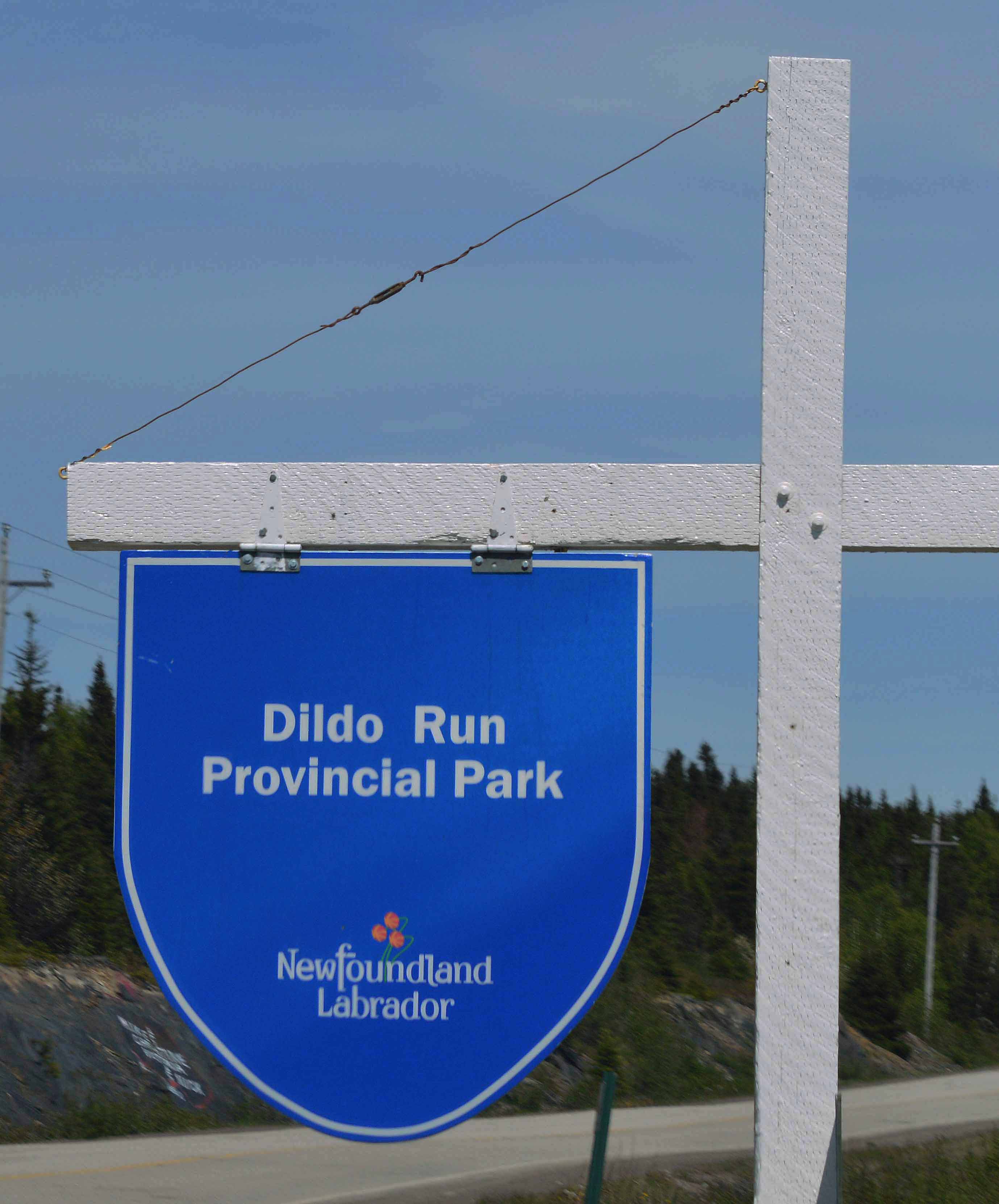
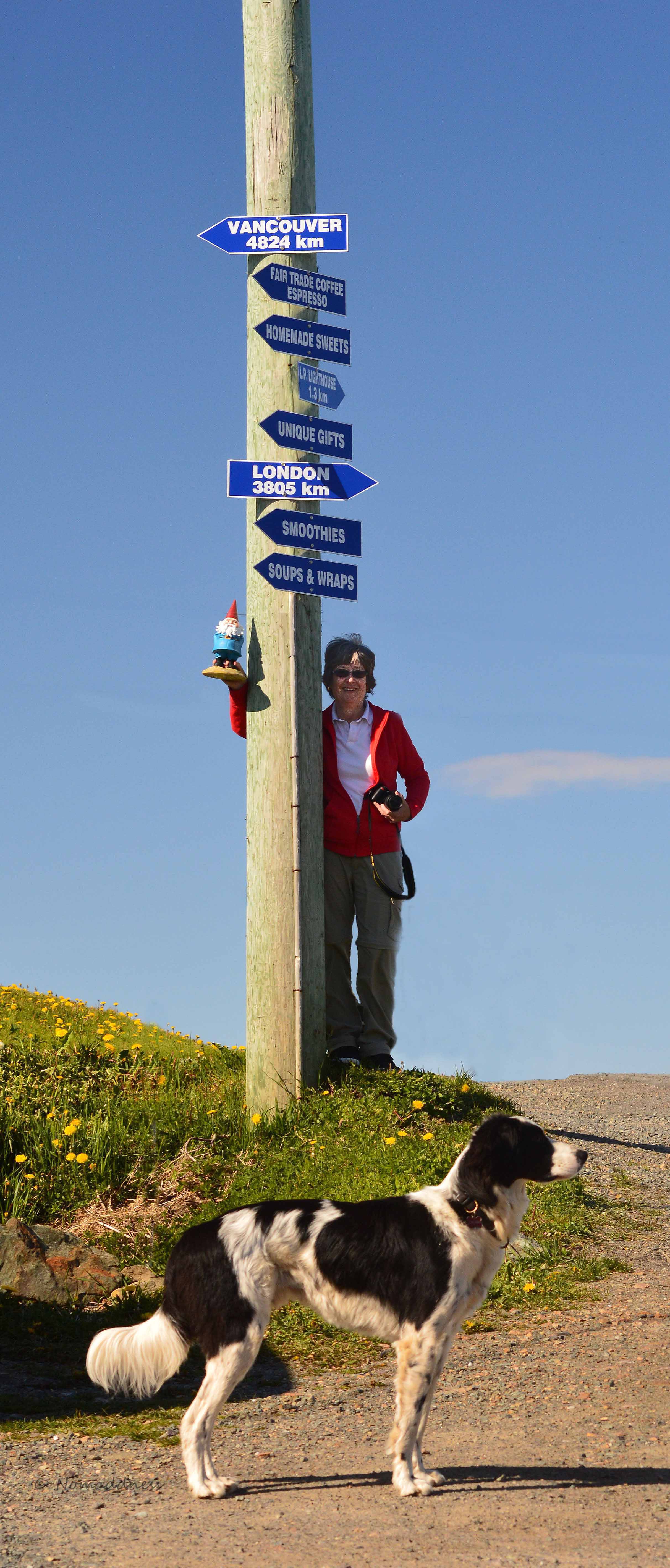
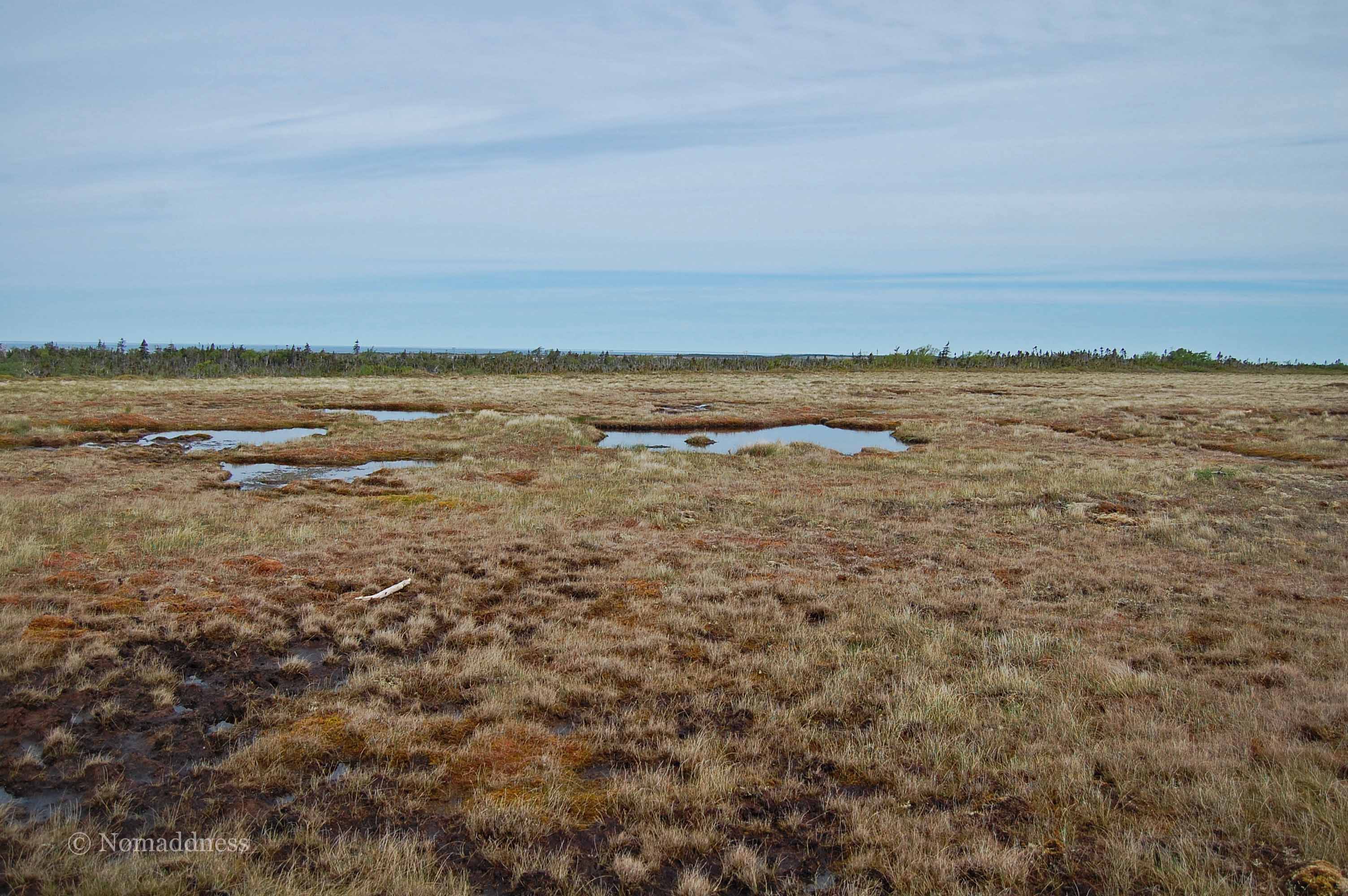
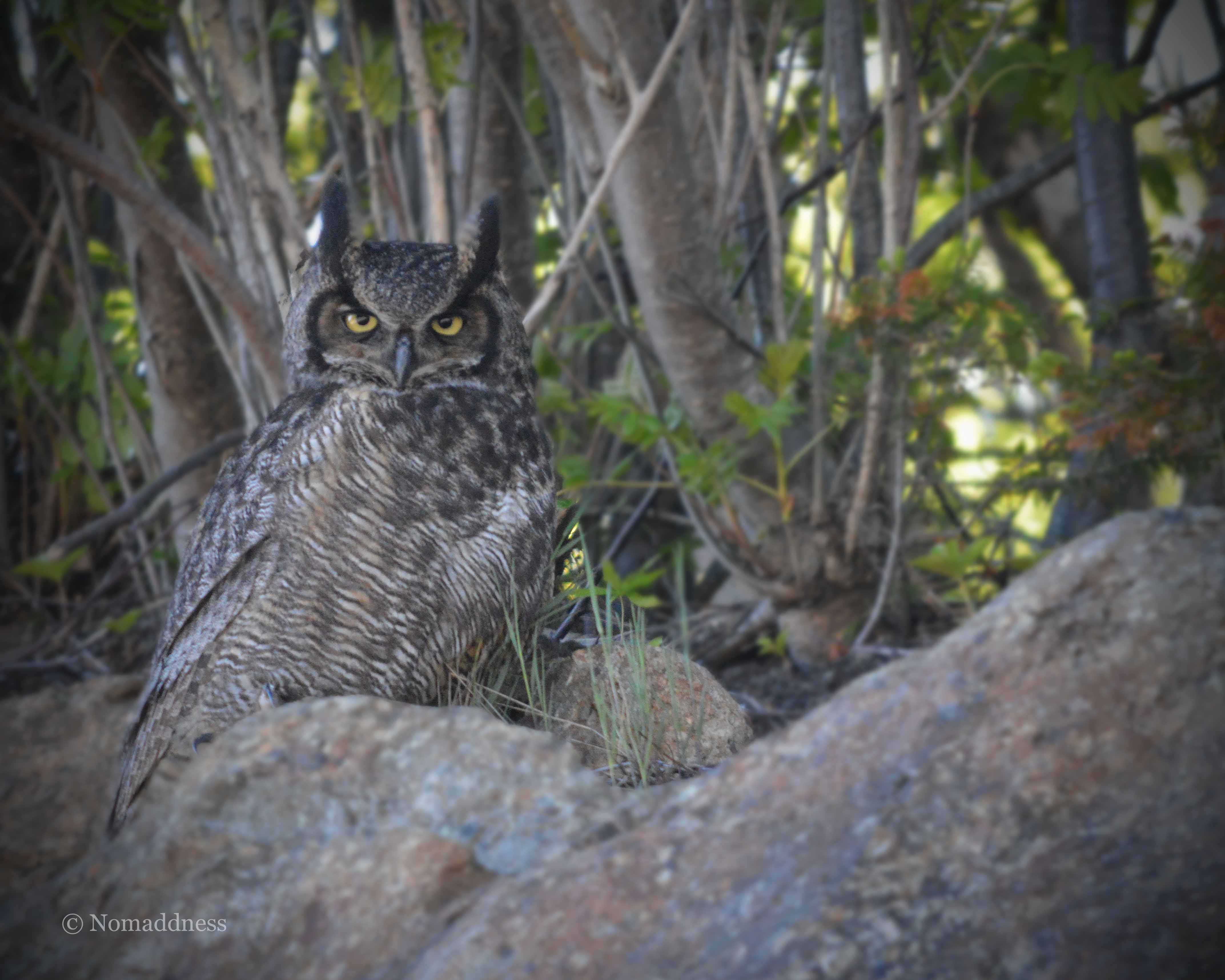
Here are a few of the other cool things we saw:

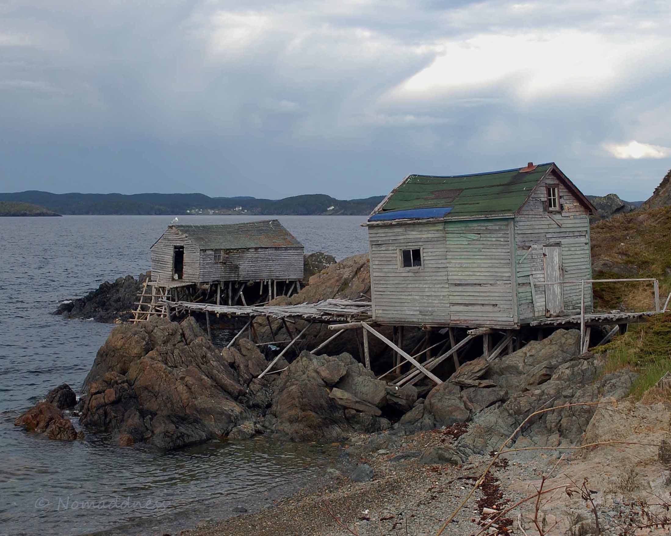
That shot of what looks like a box of rocks with birdhouses on it is an example of how Newfies put up their telephone poles. Because the island is basically just a giant slab of rock, you can’t just dig a hole and cram the pole into it. So, the box of rocks is what you’d call the holder-upper (technical term).

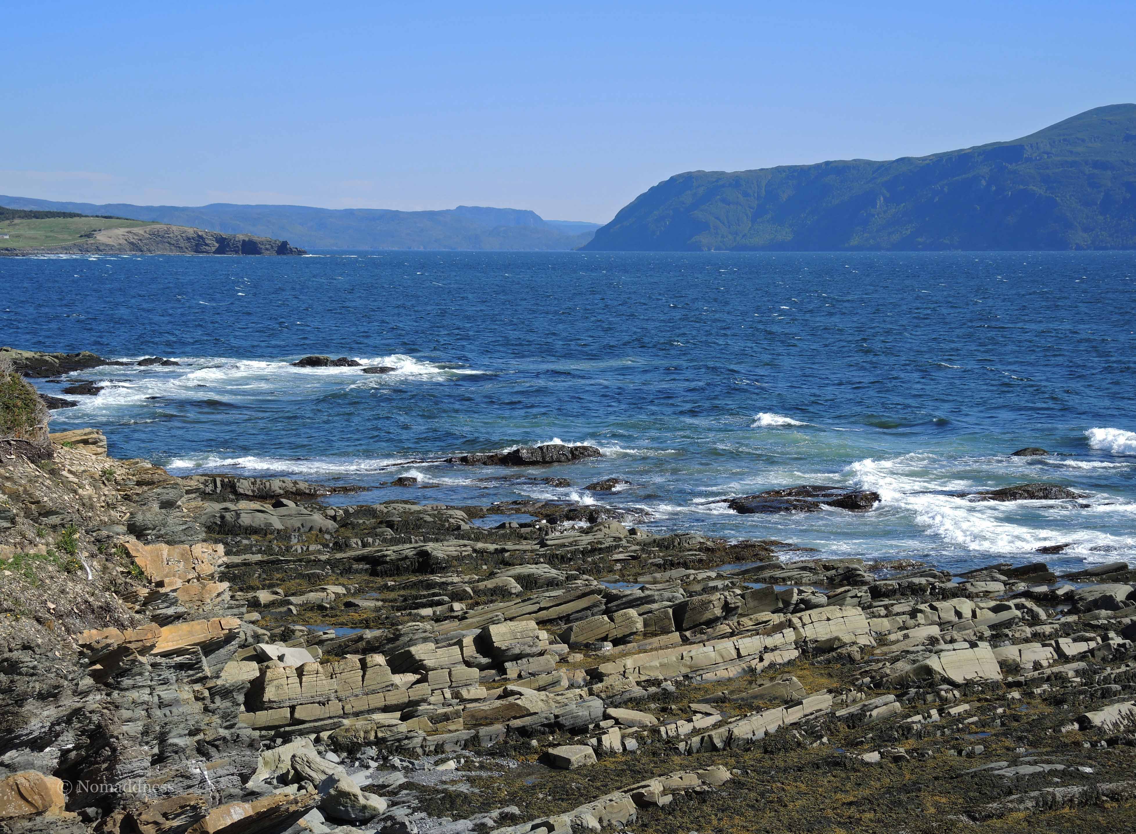
I think I’m finally ready to tell you about the second lighthouse.  I have no doubt the anticipation is getting out of hand by now.  We decided that even though our time was short and the trip to the Rose Blanche Lighthouse would be a longish drive, we’d go for it anyway.  But, uh-oh!  What’s that up there on the road?  Can it be?

SDSC_0070AR

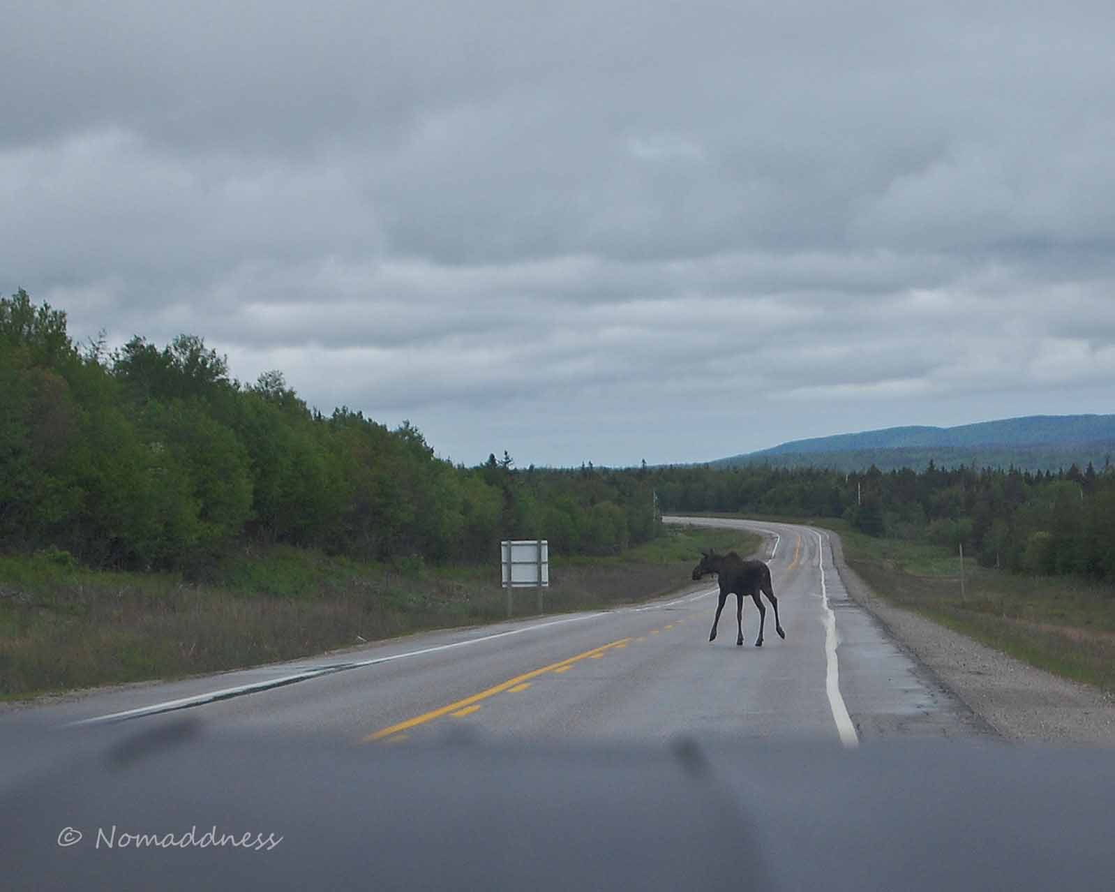
The last part of the last day and now they bust out the moose?  I just hate it when my conspiracy theories fall apart.  

JDSC_0323A
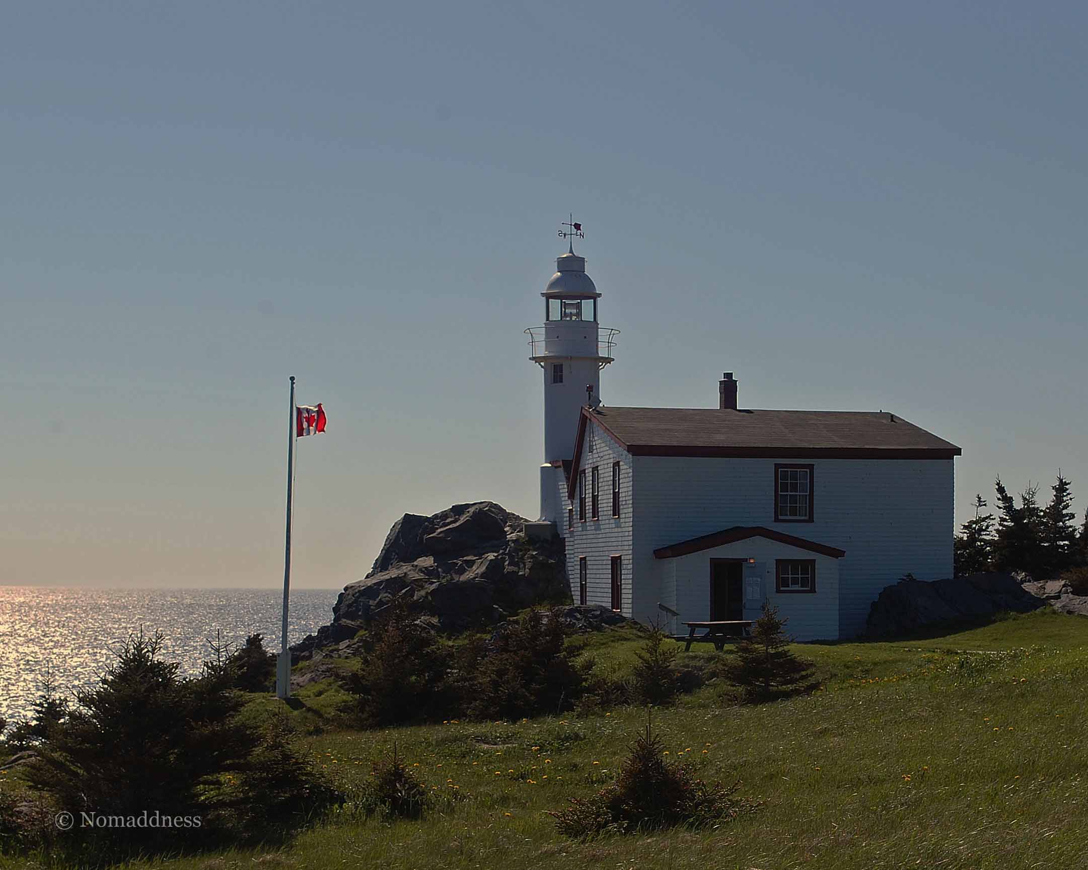
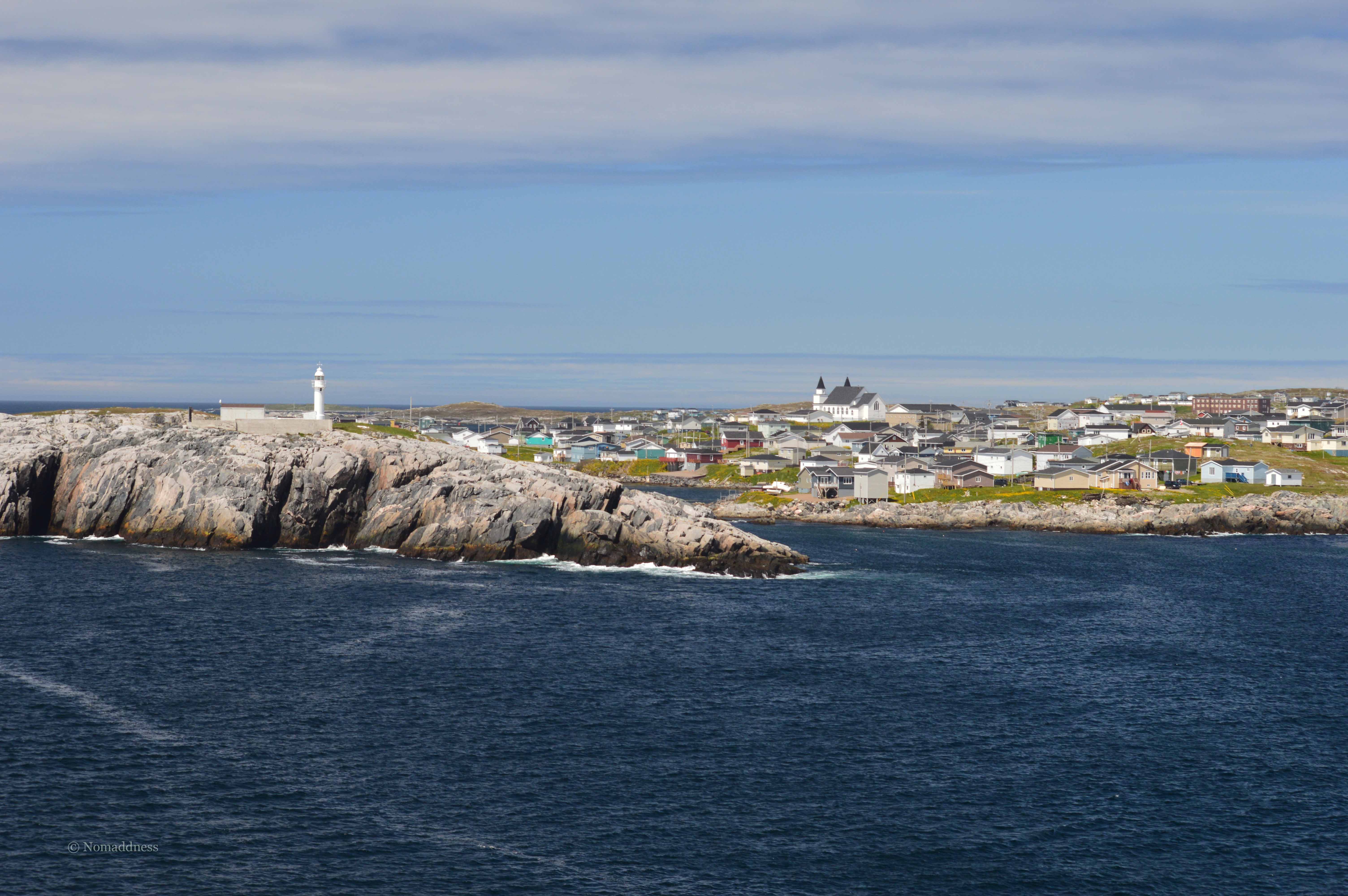
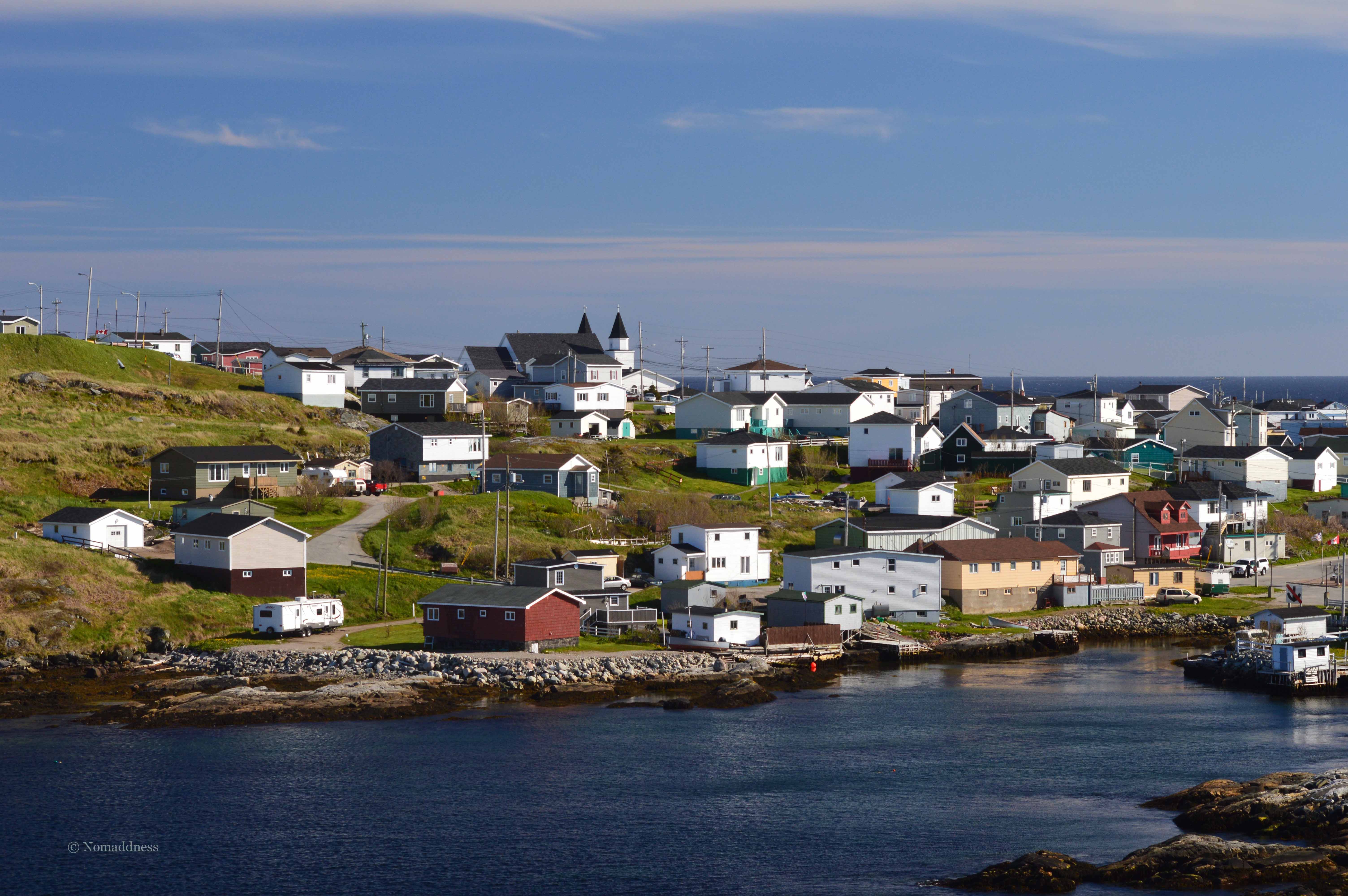
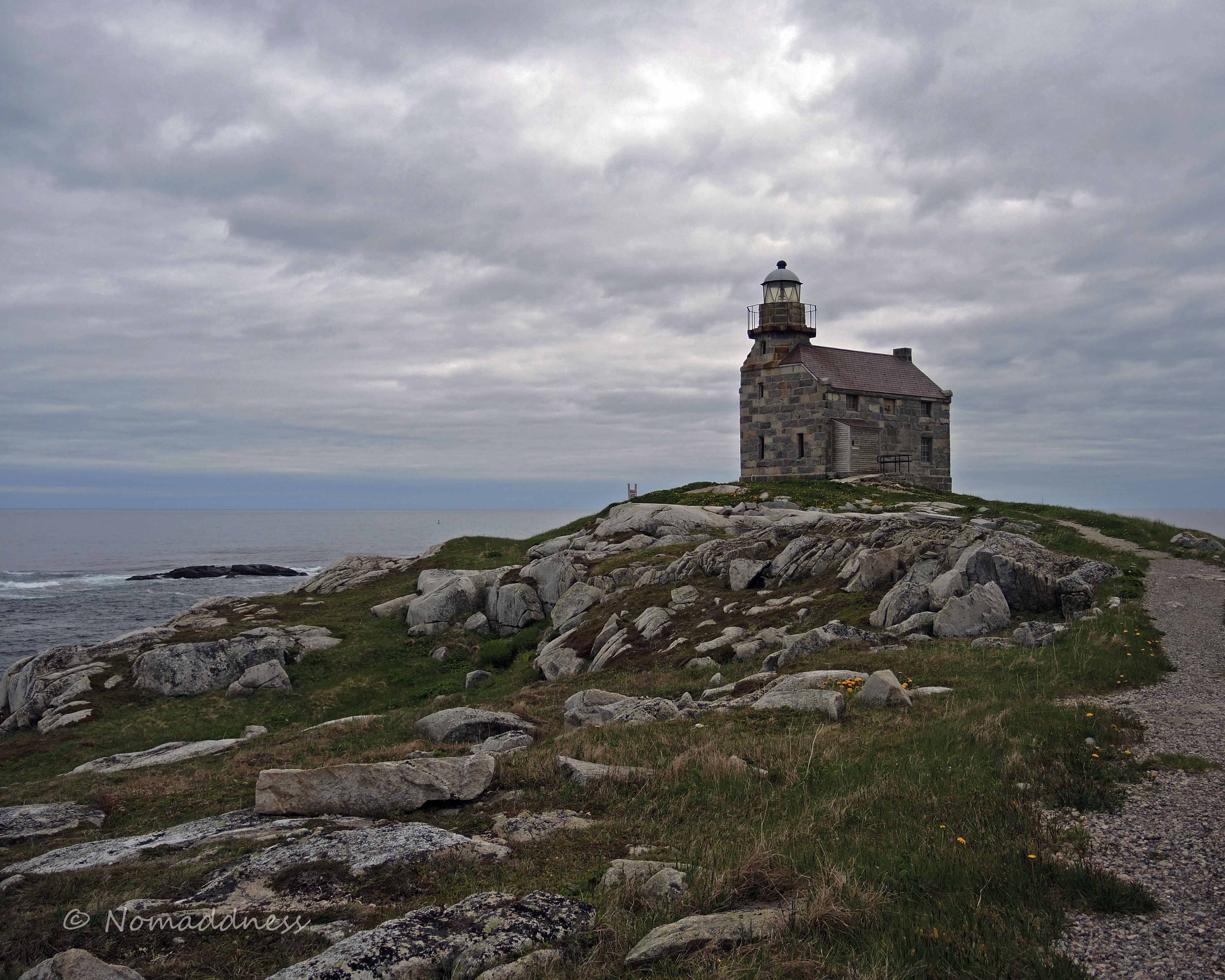
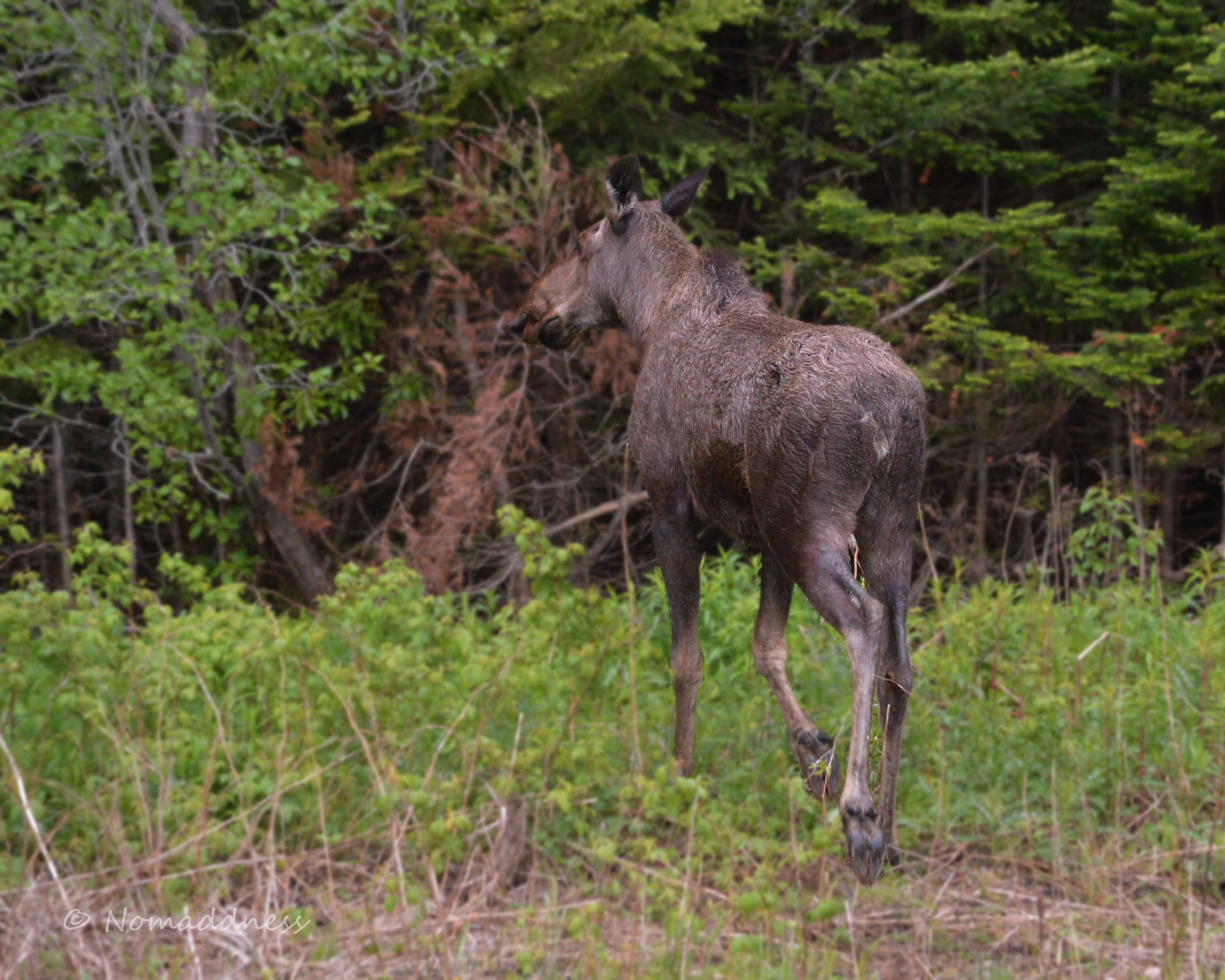
Okay, okay, I admit it:  I was (ahem) wrong about the moose thing.  Sue me.  Now, let’s just get over it and get out to Rose Blanche Lighthouse, cuz this one, my friends, is a real show-stopper.  I’ll just say two words and then let you enjoy: Solid. Granite.

Rose Blanche Lighthouse B1R


I’m sure I’ve missed some bits and pieces, so I’ll sweep it all into a bucket and do an “oops” post in a few days. Then, if the weeds in my garden will just bloody well stop growing, I’ll tell you what we saw on the way home.


The eighth day of our adventure was another travel day.  We were headed for Point F on our lovely map.

Map

See where it says “Clarenville” on there?  Well…that’s where this happened:

SDSC_1021R

As you might imagine, poor Bob was despondent. He didn’t sob openly or anything but, as you can see by the look on him, it was a near thing. His baby was broken and so was his heart.

SDSC_1014R

The guy driving the black pickup ran the red light and bonked into us.  The damage doesn’t look that bad and it’s not, really, but that rumply bit of aluminum runs the entire length of the trailer…and the door is behaving a bit strangely now.  Poor Bob…

We were back on the road again after about an hour of filling out forms and swearing oaths and whatnot at the RCMP office.

Christmas lights?  In June?!

Christmas lights? In June?!

The driver of the pickup was charged with one count of Bonking into Bob’s Baby, and Bob, who was physically restrained at all times by two sturdy women, was thankfully not charged with assault.

Happy ending!


I’m crossing off two days at once here because Day 6 was spent on the road and as I’m going through all of our zillions of photogs, it appears that nobody shot any on Day 6 (GASP!!).  But hold on to your undies, kids, cuz Day 7 is totally gonna make up for it.

Well, it will after we get the map out of the way…(Oh stop!  You know you love the map!  Geez!)

Map

Day 6 took us from Point D (D is for Dildo…c’mon…you remember this…) to Point E which is a spot called Holyrood.  We chose this place to camp for two days for a bunch of reasons, the first of which was that it offered us a chance to visit with our wayward friend, Wanda.

Wanda came to our campground (Blue Fin) under the lure of a campfire weenie roast.  Who could resist that?  Not Wanda, obviously.  Sadly, it was rainy and freezing, so we had to ix-nay the eenie-ways.  We huddled up inside the trailer while our friend regaled us with hilarious tales of her recent assimilation into Newfie society.  I guess you’d call her a Nouveau Newf, but she is still a work in progress.  So far, she’s managed to twang her long I’s but she has yet to master that odd H business.  

Wanda, girl, if the massage thing doesn’t work out, please consider stand-up as an option.  This ole world needs more laughter.  XO

The next morning, Shari, Bob, and I set out to explore.  We had a 1:30 reservation with Gatherall’s for a Puffin (!!!) and Whale Tour.  In the meantime, though, we had poking about to do.

One of the things we encountered was a small herd of Newfie Mutant Mallard Ducks.  They were unlike any mallards I’ve ever seen before.  Aside from their physical modifications, they were all sound asleep right beside (almost on) the road!  In fact, we had roared right past them before I managed to yell, “Stopppp!!” (Which is code for “I saw something interesting and I’m gonna leap out now and shoot several thousand photogs of it.”)  And, how the heck do you fall asleep standing on one foot right beside the road anyway?  You’d think the cars whooshing by would topple them, wouldn’t you?  It’s just weird, I tell ya.

Later on, after a lovely lunch of I-can’t-remember-what, we headed on over to Gatherall’s for our wee boat ride.  If you happened to be along on last year’s adventure to Maine, you’ll recall that I go a little off my stick when it comes to puffins. I can honestly admit that there has been no improvement in that area.  I can try to be cool about it, but it just bubbles up and explodes.  There’s a lot of grinning involved…and worse.

Happily, there weren’t very many people in our group. Happilier, almost immediately one of the crew spotted a humpback whale.  It was hilarious trying to get a shot off while clinging to the railing for dear life, not to mention that by the time you see the blow, it’s waaaaay too late.  The best I could do was this lovely blowhole shot (I know! I’m amazing!):

JDSC_0356ARShari had a bit more luck:

SDSC_0830RSo did Bob:

BDSCN1483RUnfortunately, this beautiful creature was just cruising and not eating or playing, so no action shots. Still…a humpback! How cool is that?!

On our trip to Maine last year, I was beyond excited about the twenty or so puffins we’d seen.  On this tour there were thousands of them!!  I was in puffin heaven!  Still and all, the lil rascals make it nigh on impossible to get a decent shot – for footballs with stubby wings, they sure can move!

This slideshow requires JavaScript.

After heading out early and determining that icebergs were not to be seen this day, we sighed, we sagged, and we soldiered on.  Thankfully, the bergs are not the only thing worth seeing in the Twillingate area.

There are innumerable tiny coves and fishing villages just waiting to be discovered.

JDSC_0824AR


Something we found really interesting were these Newfie-style root cellars.  Some of them are still in use to store taters and whatnot through the winter.  Because of the giant rock aspect of this entire island, there are no basements, so you can’t just chuck your turnips downstairs for storage.  Not that I’d ever do that.  Turnips are disgusting.  Just sayin’.


Mother Nature let us down with the icebergs, but it was a wonderful day all the same.


Oh geez, by, not da map again!

Oh c’mon, be honest, you were missing my beautiful map, I know you were.

Map

On Day 4, we meandered from Point C, Gros Morne, to Point D, which is….I’d better show you – you’ll never believe me if I just say it.

JDSC_0031

Now, I know what you’re thinking – you’re wondering if I’m alphabetically challenged because there appears to be a Point F in between Points C and D on that amazingly glorious map.  As it happens, the F-stop (little photog humour there – heh heh) comes later, after we’d been to E and back (that woulda been a lot cornier if I’d said L instead of E…).  But I’m getting ahead of myself.  First, we went to Dildo Run.

We chose this spot to camp for two days not only because the name made us giggle, but because it’s close to Twillingate, and, as we all know, Twillingate is the Iceberg Capital of the World.  Turns out it’s pretty much like the moose business, but, I’m getting ahead of myself again.

While The Bob was setting up the trailer, Shari and I were excused from turnip detail so we went wandering around with our cameras.  Almost immediately, a really nice Newfie man approached us and asked if we’d been to photograph the owls yet. Given my “thing” for owls, I began to bounce up and down and I had a heck of a time concentrating on the directions the man was giving us.

“G’wan down tada stop soign ‘n’ hang a right, right?”

Right.”

Den ya take dat road a ways an’ y’ll see oh I dunno foive er six ‘ouses dere, ‘n’ ya g’wan right on by dem ‘ouses.”

Right…go past the houses…check!”

After a ways y’ll see a pond. Pull over by da pond and y’ll see doze owls up ‘ere inna rocks, eh?”

Right…stop at the pond and look up in the rocks…check!”

But deres a lotta rock so ya gotta look fer da poop, okay?”

Right! Look for the poop! Got it!”

So off we went, right turn, down the road, past the ‘ouses, pond, park, poop, and ta dah!  Just as he’d said.  I showed you a couple of the pictures the other day – if you missed it or you wanna look again, click HERE.  There’s something otherworldly about standing there being stared at by a Great Horned Owl.  It’s unbelievably cool.

After Bob dragged me back to the car, we went exploring around Twillingate.

The first stop was (yet) another lighthouse (yay!):

This slideshow requires JavaScript.

Unfortunately, we arrived too late to hand over a wad of cash and visit the Whatever-it-was Exhibit in this unusual lighthouse.  We’re still trying to get over that.

Since as I said Twillingate is the (ahem) Iceberg Capital of the World (snort), we decided to venture in to town and find out where all the icebergs were.  We heard from several sources that we “just missed one – har har har.”  We were beginning to see a pattern…

With no icebergs to see, we poked around the town and the area for a while. We happened upon a sign that said that Vancouver was 4824 kms away. This amused us greatly because that’s where Shari is from. I insisted that she pose for a photog (for her mom) and she and Gnomey assumed the position. I was just about to take the shot when this lovely dog materialized and struck this lovely pose. Not exactly a photo-bomb, but kinda.

JDSC_0084DR

If he’s a pointer, he’s doing it wrong.  Just sayin’.

We goofed around Twillingate until it was hungry time whereupon we laid siege to a fish ‘n’ chips shop and stuffed our faces.

After dinner, we waddled back out to the car and headed back to the campground with the silly name thinking we’d get up early and go check on the iceberg status.

I hate to disappoint, but there’ll be no incredibly awesome map today.  Only because we were still in the same place: Gros Morne.

Our Trip Research Technician had sussed out a number of interesting spots for us to scope out.  Team Turnip seemed to be enjoying letting him do all of the work (travelling with a control freak does have its perks…sometimes).

We began our day by falling into the car clutching our coffee mugs and meandering up the coast to the site of a shipwreck.  The S. S. Ethie, a wooden steamship, ran aground in 1919 in a terrible storm.  (If you’re interested in the details, click HERE for an excerpt from the ship’s log.  It’s a short, interesting read.  Seriously, click it.  Would I steer ya wrong?  Geez…I hope the Captain of the S. S. Ethie didn’t say that…)  Nearly a hundred years later, all that’s left are a wood thing (technical term) and the metal bits of the ship, and they’ve just been left as they landed – rare for something of interest to tourists.  No gift shops, no ticket booth, no velvet rope – just the bits of the wreck lying in the surf.  Cool, eh?

Once we’d shot our photogs of the wreck, we piled back in the car and headed a little further up (or possibly down) the coast to a place called Arches Provincial Park.  Not quite as impressive as the Utah Arches we visited last year but still pretty cool.

Next, we had planned to go and see the Cow’s Head Lighthouse, but for reasons that are as odd as they are classified, we decided against it (Okay, okay, one of us had to pee rather urgently so we went in search of a potty instead. Happy now?).

On the way to find the potty, we saw stuff like this:

Once business was taken care of, we tossed around some ideas and came up with this:  “5km hike in through a bug-infested bog for no apparent reason.”  Hey, who wouldn’t vote for that one?!  There actually was a reason at the time, but it sorta fell apart in the execution.  We went out to a place called Western Brook Pond, which offered what sounded on paper like a really cool boat tour.  The downside was that you had to hike 2.5 kms through the swamp to get to the boat.  The downer-than-that-side was that when we got there, we were alone.  I mean alone alone.  There was a building and there were boats, but no people.  We stooged around for a while until a couple of worker bees showed up and informed us that we were about two hours early for the boat tour. What?! You mean the internet is WRONG?! Inconceivable! (Little Princess Bride reference there…heh heh….oh,never mind…)  So, once again, one (or more) of us had to pee desperately so we decided to hike back to the parking lot where the potty was.  It wasn’t a total write-off, though.  We did see some interesting things along the path. Well, okay, some of it looked like this:

Western Brook Pond SDSC_0421R

But some of the other parts were nice.

AND!! You’ll be excited to hear that I saw some birds I’ve never seen before!

By then it was just coming up on lunchtime and we were already exhausted. We went back to the trailer, ate lunch and declared it to be Nap Time.

Map


We arose bright and early and began our trek up the coast to Point C on our astonishingly brilliant map that we’re not too proud to reuse, possibly several times: Gros Morne National Park.

DSC_0254R(Don’t say I didn’t warn ya about the signs!)

If you’re curious, as I am, and you’re not fluent in French, you may find yourself wondering what Gros Morne means.  Permit me to elucidate:  Don’t bother with Wikipedia because they’ll define it as something flowery like (cue music) “Great mountain that stands alone.”  However, if you’re crafty like me, you’ll go straight to the Google translator thing and find that Gros Morne actually means “large dull.”  Yeah, I can see why Wikipedia would wanna tweak that…

We arrived at the Gros Morne KOA around mid-afternoon, chucked the trailer, and set out to explore.  Our Trip Research Technician (Bob) had determined that Gros Morne was a lovely area with lots to see and do.  As is sometimes the case, he was right.  Our first stop, which you’ve already seen but pretend you haven’t, was the Lobster Head Cove Lighthouse (Oh lord…not another lighthouse! Shush!). Happily, there were no lobster heads lying around and the scenery was spectacular:

DSCN1135R


Lobster Head Cove Lighthouse 1R


(That’s Bob’s other wife in that one shot.  The one sitting on the rocks, not the one with the wings.)  (The shot with the obscenely blue sky was just me playing with my new polarizer.  🙂 )

We were pretty beat after a long driving day so we headed back for an early dinner and a rest-up for the next day’s adventuring.


I figured it was time to stop bubbling away about how cool Newfoundland is and get down to the business of chronicling our adventure. So here goes:

Map

Nine Days of Newfoundland – Day 1

Newfoundland is the island bit of the easternmost province of Canada. It is a world apart, not only geographically, but in every other way I can think of.

Getting there requires taking a six-hour ferry ride. And it ain’t cheap! If you’re travelling with an RV, they measure you from nose to stern, car and trailer, then they ding you $12.00 for every foot of space you take up on their boat! And that’s not counting the people charges of forty-odd dollars each. It’s a painful experience, but it’s the only way you’ll get your RV to The Rock.

DSC_0121R

DSC_0123R

All goods and etceteras are transported on the ferry too. If you think this sounds as though it just might jack the grocery prices up a tad, you’d be thinkin’ right, amigo!

DSC_0156R

The ferry pulled into port at point A on that really awesome (right?) map up there that I slaved over for days (I’m soooo not a map person), a place called Port aux Basques, or sometimes Channel-Port aux Basques (or Port O’Bask if you’re Irish), Newfoundland.

DSC_0299R

DSC_0066R

Observations:

Geography: Rock and water

Vegetation: Not so much

Architecture: Clinging for dear life to the rock

We lumbered up the road a ways and made camp for the first night at a lovely spot called, um…the Grand Codroy RV Park (Whew!  Good thing I had that written down, eh?)(Point B on our lovely map up there…), which offered warm Newfie hospitality among its other amenities (free firewood!). It was just a stopover for the night on our way up the coast, but we felt at home there.

Bob’s other wife, Shari, has a thing for signs, so you may see a few salted in here and there.

DSC_0220R

Great Horned Owlet - Nfld 2


….or its mother?

Great Horned Owl - Nfld


Yep, I think junior needs to work on his blistering glare a bit.  When I saw the little guy, I just wanted to grab him and squeeze him.  Mom definitely has the hang of it!

Just a few amazing moments from our Newfoundland trip.  Oh, c’mon, you knew there’d be birds in there somewhere!

Alas, we didn’t see any icebergs, but we saw these two beauties!


DSC_0023ARNewfie Graffiti

The Newfoundland dialect is a constant source of amusement for us as we make our way around this intriguing province.  It apparently differs slightly from town to town and locals in any given area can spot outsiders or pinpoint one’s lineage in some way that will forever remain a mystery to us Mainlanders.

Newfies generally greet each other thusly:  “Howya gettin’ on?” If a male Newfie is greeting another male, it amends slightly to “Howya gettin’ on, by?”  (As near as I can figure, “by” is just “boy” without the “o” and not a reference to either sexuality or mental health issues.)

Aside from local dialects, there are certain constants which distinguish Newfie speech from, well, everyone else’s:

All common uses for the letter H have been abolished in Newfoundland.  For example, if you wanted to say something like, “I’ll take the other half of that,” you’d have to say “Oil take de udder affa dat” if you wanted to pass for a Newf.

You’ll notice I said “oil” there instead of “I’ll.”  This incredibly graceful segue brings us to another rule of Newfie speech:  Words containing a long “i” sound (such as “eye spy with my little eye”) are replaced by “oy” (not to be confused with the Jewish version, which is its own word).  For example, “What time is it?” becomes “Whut toyme ya got, by?” to which you might reply, “It’s tree minutes ta noyne.”

Newfie’s tend to femalize inanimate objects.  Things are referred to as her or she.  Because of the no-h rule, “her” becomes “er.”  “She,” however, has been granted amnesty under some sort of rule exception clause and remains “she.”  I have no other explanation for this.

The reason for my desire to attempt to decipher this Newfie code-talking business came on the heels of my having overheard a guy talking on his cellphone (amazing in itself considering how exquisitely rare cell signals are on The Rock).  The gist of the conversation was that Buddy A was lending something to Buddy B.  Here’s what I heard:

“Howya gettin’ on, by?”

“Yeah, gettin’ on good too.”

“No, no, just callin’ ta tellya she’s round back by da fence.”

“Yeah.”

“Yeah.”

“Yeah, picker up an’ gwan widder.”

That’s when I lost it.  From that moment on I am resolved to somehow find a way to use “picker up an’ gwan widder” in conversation.

Please feel free to use these linguistic guidelines yourself should you ever find yourself in conversation widda Newf.

DSC_0386R